------------------------------------
Step 1: The Locations
------------------------------------
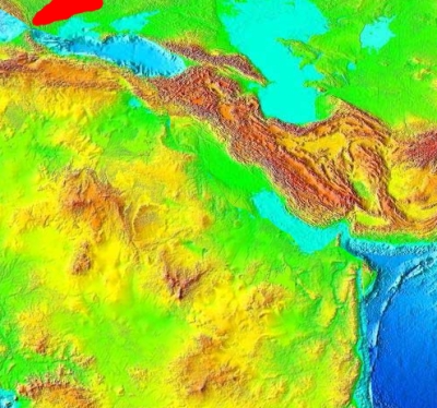
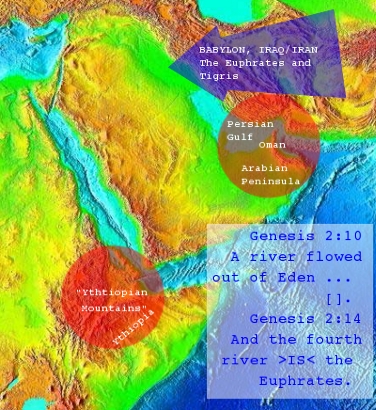 And checking up for this location we can easily find that by drawing aline from the "canyon"
in the "Ythiopian Mountains" to the tip of Oman, we can draw another one almost straight 90
degrees to it crossing through Persian Gulf and the Euphrates.
And checking up for this location we can easily find that by drawing aline from the "canyon"
in the "Ythiopian Mountains" to the tip of Oman, we can draw another one almost straight 90
degrees to it crossing through Persian Gulf and the Euphrates.
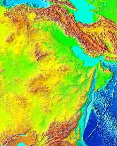
Checking for the next best hints, the Dig for Gold seems appropriate:
A river flowed out of Eden to water the garden, and there it divided and became four rivers. The name of the first is the Pishon. It is the one that flowed around the whole land of Havilah, where there is gold. And the gold of that land is good; bdellium and onyx stone are there. ...
The name of the second river is the Gihon. It is the one that flowed around the whole land of Cush.
And the name of the third river is the Tigris, which flows east of Assyria.
------------------------------------
Step 2: Taking it up with Finetunes
------------------------------------
 ) and I saw "the Lions Dance"
 But these days, the luxury to play with such
fancy funny little things is out. Looking for
a while at a
finished result
on this base, it seems propper to take the
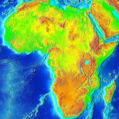
entire continent of Africa instead - so for now, and heres
a little look at it:
But these days, the luxury to play with such
fancy funny little things is out. Looking for
a while at a
finished result
on this base, it seems propper to take the
entire continent of Africa instead - so for now, and heres
a little look at it:
 But counting in, from this rather random from
inspiration approach, the previous dance, the
result ON EXACTLY 45 degrees of rotation and
a little bit of erasing and un-erasing we get
(
But counting in, from this rather random from
inspiration approach, the previous dance, the
result ON EXACTLY 45 degrees of rotation and
a little bit of erasing and un-erasing we get
(
 ) where we can find that the
turkey mountains harmonize with the African
Mainland.
) where we can find that the
turkey mountains harmonize with the African
Mainland.
 This last image was made from taking the entire
map, rotating it 45 degrees and erasing the
central parts as seen fit.
This last image was made from taking the entire
map, rotating it 45 degrees and erasing the
central parts as seen fit.
------------------------------------
Step 3: Thinking of Horse-Power
------------------------------------
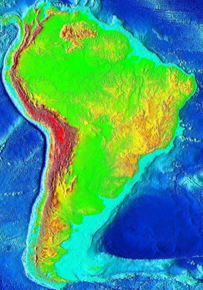
 ) - and so, although South America didn't
match to Africa, North America matched
to it and so did it match to Mesopotamia,
which furthermore matched to Africa and
so we got an open circle that may be confused
due to the fact that the globe is a sphere
and not a square checker-board.
) - and so, although South America didn't
match to Africa, North America matched
to it and so did it match to Mesopotamia,
which furthermore matched to Africa and
so we got an open circle that may be confused
due to the fact that the globe is a sphere
and not a square checker-board.
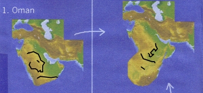
Comparing the last edit of attaching Africa
to Mesopotamia reveals a destinct form of
match to its environment that is definately
superior to the others.
And equally so we can find such matches by
attaching North America to the plate:
---
